
Trust infrastructure
for spatial data.
Trace the origin, custody, and change of your spatial data. Validate with confidence. Prepare it for analytics, AI, compliance, and critical decisions.
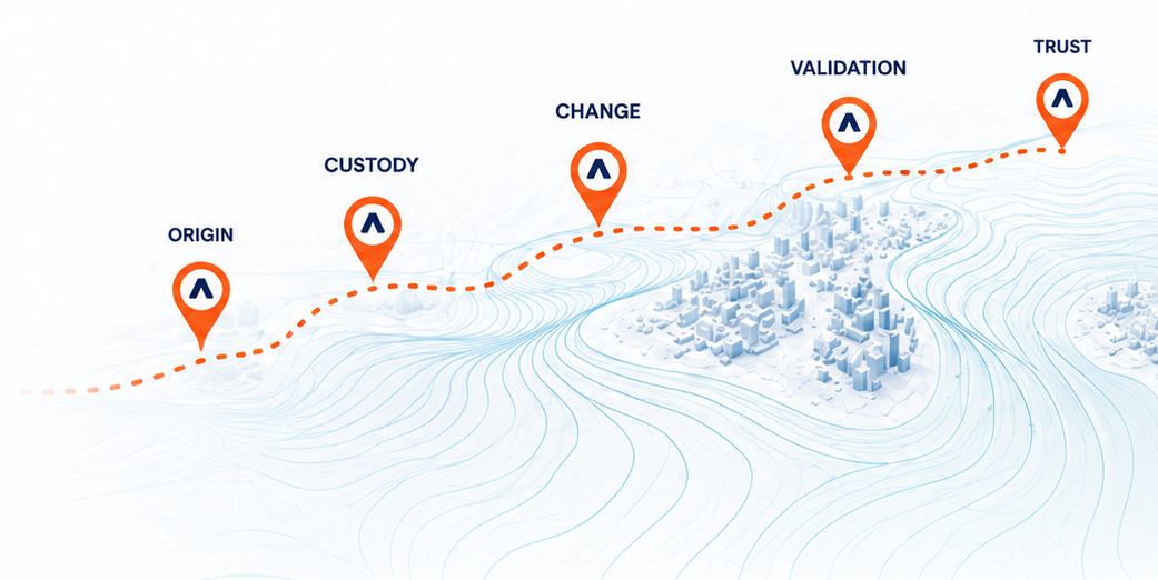
ORIGIN
Where did the data come from?
CUSTODY
Who handled it and when?
CHANGE
What changed and why?
VALIDATION
How was it checked?
TRUST
Is it ready for use?
A map can look authoritative and still be difficult to verify.
Origin can become unclear
Sources, methods, dates, vendors, and approvals can become separated from the dataset.
Changes are difficult to trace
Edits and updates are often buried inside files and systems.
Quality depends on manual review
Topology, schema, coordinates, and completeness checks can be inconsistent.
Decisions need clearer evidence
Teams need confidence that data is current, validated, and authoritative.
Provenance you can
pinpoint.
Attashe creates a clear system of record for spatial data origin, custody, change, validation, and authoritative versions.
Provenance & Lineage
Capture source, custody, ownership, approvals, and transformations.
Spatial Version Control
Compare versions, see feature-level changes, and manage authoritative records.
Quality & Validation
Apply topology, schema, and rules-based checks to validate readiness.
Audit-Ready Evidence
Generate readable history for review, compliance, and accountability.
Start by understanding what your spatial data can prove.
The TRUST Audit evaluates how spatial data is sourced, managed, changed, validated, governed, and prepared for analytics or AI.